Here’s the latest update on Tropical Depression Dodong according to PAGASA
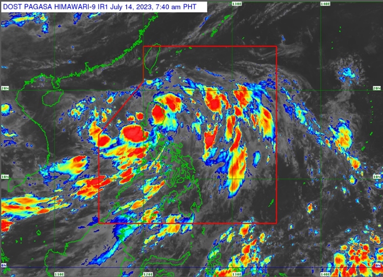
TROPICAL DEPRESSION DODONG – PAGASA announced via its latest bulletin issued at 8 AM today, July 14, 2023, that it turns north northwestward over the Cagayan valley and is now over the northwestern Cagayan area
It is traversing North Northwestward at 25 km/h and has maximum sustained winds of 45 km/h near the center and gustiness of up to 75 km/ha. The center of the eye of Tropical Depression Dodong was located in the vicinity of Lasam, Cagayan (18.1 °N, 121.5 °E )
Tropical Cyclone Wind Signal No. 1 has been raised in the following areas: Cagayan, Isabela, Apayao, Kalinga, Abra, Mountain Province, Ifugao, Benguet, Ilocos Norte, Ilocos Sur, La Union, and the northern portion of Pangasinan (San Nicolas, San Manuel, Sison, San Fabian, Pozorrubio, Bolinao, Bani, City of Alaminos, Sual, Labrador, Lingayen, Agno, Binmaley, Dagupan City, San Jacinto, Mangaldan, Anda)

There are several hazards affecting different areas in the Philippines. Heavy rainfall is expected in provinces like Cagayan, Isabela, and Quirino, which could result in flooding and landslides in susceptible areas. Strong winds, ranging from strong breeze to near gale strength, may occur in regions including MIMAROPA and Bicol Region. Coastal waters along the eastern and western seaboards of Northern Luzon, as well as Central and Southern Luzon, may experience moderate to rough seas. Small seacrafts are advised to take precautions before venturing out.

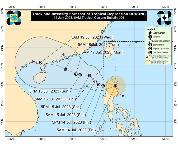
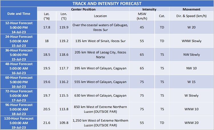
Tropical Depression Dodong is projected to move westward across northern mainland Luzon, then continue northwestward over the West Philippine Sea before leaving the Philippine Area of Responsibility. It may intensify into a tropical storm during its journey over the West Philippine Sea.

Meanwhile, according to PAGASA, the next update about Tropical Depression Dodong will be issued at 11 AM today.
For more news and the latest updates, feel free to visit Newspapers.ph more often as well as our Facebook page and YouTube channel.
