Super Typhoon Betty latest update
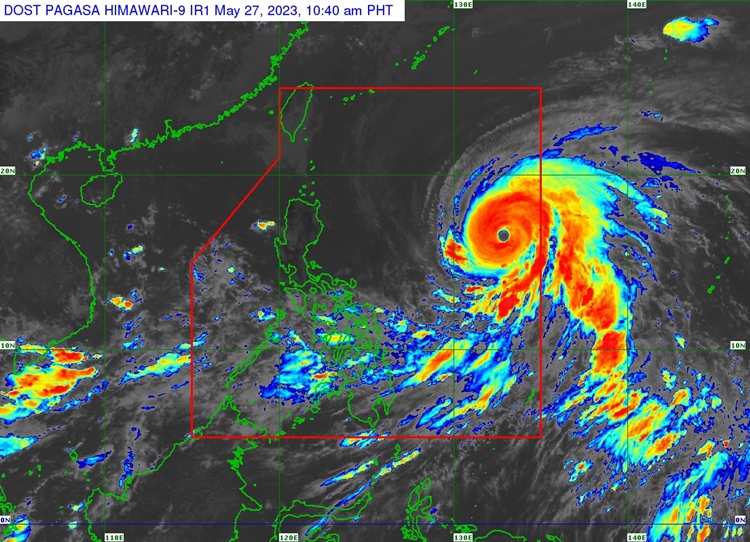
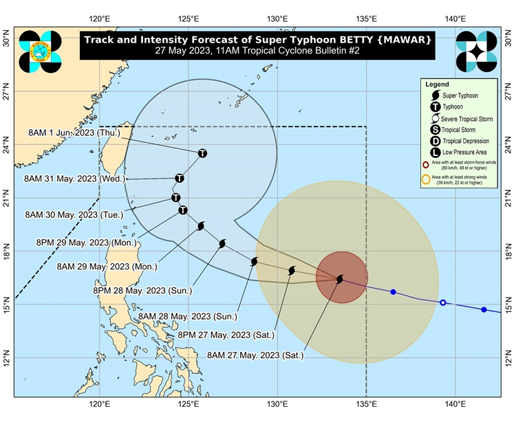
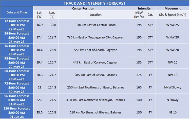
SUPER TYPHOON BETTY – PAGASA announced via its latest bulletin issued at 11 AM today, May 27, 2023, that it maintains its strength while moving west-northwestward.
It is traversing West Northwestward at 30 km/h and has maximum sustained winds of 195 km/h near the center, gustiness of up to 240 km/h, and a central pressure of 915 hPa. The center of the eye of Typhoon Karding was located 1,170 km East of Central Luzon (16.4°N, 133.1°E)
Tropical Cyclone Wind Signal no. 1 has been raised in the following areas: eastern portion of Cagayan (Santa Ana, Gonzaga, Lal-Lo, Gattaran, Baggao, Peñablanca, Santa Teresita, Buguey) including Babuyan and Camiguin Islands and the eastern portion of Isabela (Maconacon, Divilacan, Dinapigue, Palanan, San Mariano, Ilagan City, Tumauini, San Pablo, Cabagan).
In areas not directly impacted by the super typhoon, there is a possibility of monsoon rains from the enhanced Southwest Monsoon occurring tomorrow in the western parts of MIMAROPA, Visayas, and Mindanao. During Monday and Tuesday, monsoon rains are expected in the western areas of MIMAROPA and Western Visayas, and there is a chance of monsoon rains in the remaining parts of MIMAROPA and Western Visayas.
Under these circumstances, there is a likelihood of flooding and landslides caused by the rain, particularly in areas that are highly or very highly susceptible to these hazards as indicated in hazard maps. Localities that have already experienced significant rainfall over the past few days are also at higher risk.
Meanwhile, according to PAGASA, the next update about Supter Typhoon Betty will be issued at 5 PM today.
For more news and the latest updates, feel free to visit Newspapers.ph more often as well as our Facebook page and YouTube channel.