PAGASA Latest Weather Update on Tropical Depression Florita
TROPICAL DEPRESSION FLORITA – PAGASA announced via its latest bulletin issued at 5 AM today, August 22, 2022, that it maintains its strength as it moves west-southwestward over the Philippine sea east of Cagayan.
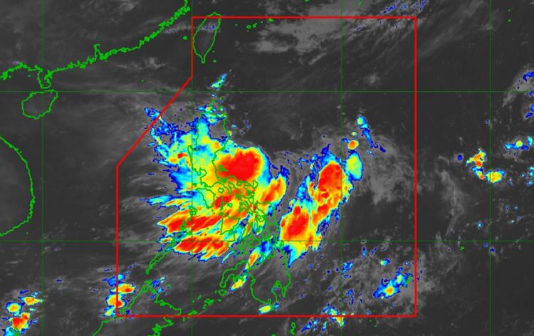
It is traversing West Southwestward at 20 km/h and has maximum sustained winds of 55 km/h near the center and gustiness of up to 70 km/h.
At 5:00 AM today, the center of the eye of Tropical Depression Florita was located at 310 km East of Casiguran, Aurora (16.5 °N, 125.0 °E).
Tropical Cyclone Wind Signal no. 1:
LUZON – Cagayan, Isabela, Quirino, Nueva Vizcaya, Apayao, Abra, Kalinga, Mountain Province, Ifugao, Ilocos Norte, Ilocos Sur, and the northern portion of Aurora (Dilasag, Casiguran, Dinalungan, Dipaculao).
According to PAGASA, light to moderate with at times heavy rains are possible over Cagayan, Isabela, Batanes, and Aurora until tonight.
While heavy to intense with at times torrential rains over Cagayan, Isabela, Batanes, Cordillera Administrative Region, and Ilocos Region; moderate to heavy rains over the northern portion of Aurora, Zambales, Bataan, and the rest of Cagayan Valley; and light to moderate with at times heavy rains over the rest of Central Luzon are expected tonight through tomorrow evening (August 23).
Its forecast position today at exactly 02:00 PM will be 210 km East of Casiguran, Aurora.
PAGASA said the next update about Tropical Depression Florita will be issued at 11 AM today.
(Refresh this page for updates. We will post the 11 AM updates here.)
For more news and the latest updates, feel free to visit Newspapers.ph more often as well as our Facebook page and YouTube channel.