Typhoon Rolly Intensifies As It Moves Towards Philippines, According to PAGASA
The state weather bureau PAGASA reported that Typhoon Rolly has intensified as it moves closer to the Philippines landmass.
On Friday afternoon (October 30, 2020), the Philippine Atmospheric, Geophysical and Astronomical Services Administration released the latest update about Typhoon Rolly. The weather disturbance is currently heading for the country.
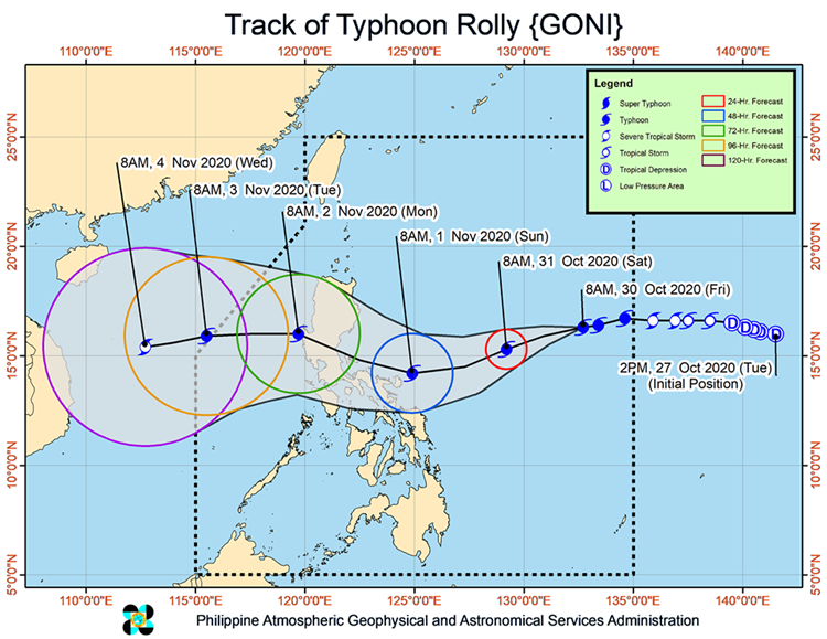
Typhoon Rolly has been last spotted at 1,100 kilometers east of Central Luzon. Rolly has maximum sustained winds of 165 kilometers per hour and gustiness of up to 205 kph moving at a speed of 15 kph.
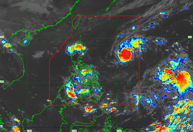
The typhoon’s trough or extension would bring light to moderate with and occasionally heavy rains over Bicol Region, the Visayas, Caraga, Northern Mindanao, and Zamboanga Peninsula, according to the weather bureau.
PAGASA predicts that the typhoon may reach its peak as it is expected to hit Aurora and Quezon provinces on Sunday evening (November 1) or Monday morning (November 2).
The weather agency is currently monitoring another weather disturbance with maximum sustained winds of 65 kph and gustiness of 80 kph. The disturbance has an international name “Atsani”.
The tropical depression is expected to enter the Philippine Area of Responsibility this weekend.
What can you say about this recent weather update? Just leave your comments and suggestions for this report.
You can also read: Disappointed Netizen Shares Video of Overcrowded Motorists Redeeming License