Super Typhoon Sinlaku Unlikely to Enter PAR, Says PAGASA
PAGASA – The Philippine Atmospheric, Geophysical and Astronomical Services Administration is currently monitoring Super Typhoon Sinlaku, although it is not expected to directly affect the Philippines.
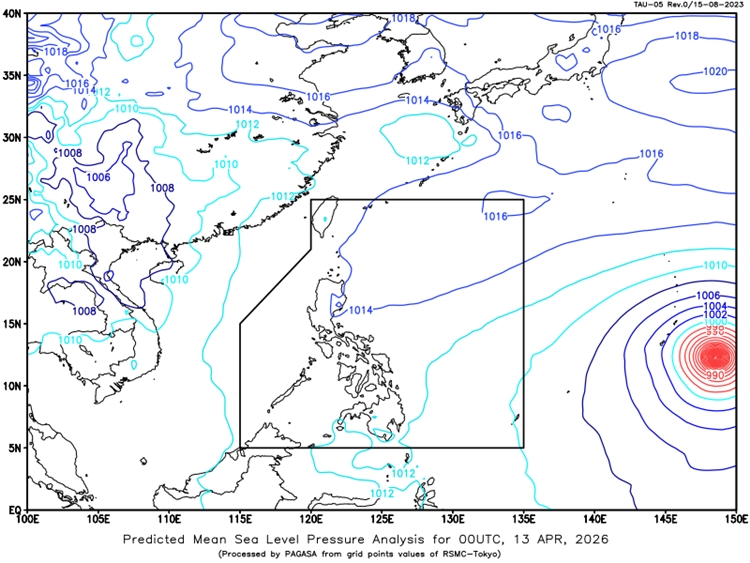
As of early morning on April 13, 2026, the typhoon was located about 2,580 kilometers east of the Visayas, with maximum sustained winds reaching up to 205 kilometers per hour and gusts of up to 250 kilometers per hour. It is moving west-northwestward at a speed of 15 kilometers per hour, but forecasts show that it is likely to head toward Japan instead of entering the Philippine Area of Responsibility.
According to weather experts, the typhoon has a low chance of entering the country, which means it is not expected to bring any significant direct impact on Philippine weather conditions. Because of this, most parts of the country, including Metro Manila and nearby areas, are expected to experience generally fair weather. Skies may range from partly cloudy to cloudy, with only isolated rain showers or thunderstorms caused by localized weather patterns. While these brief rains are not expected to be widespread, they may still lead to minor risks such as flash floods or landslides, especially during stronger thunderstorms.
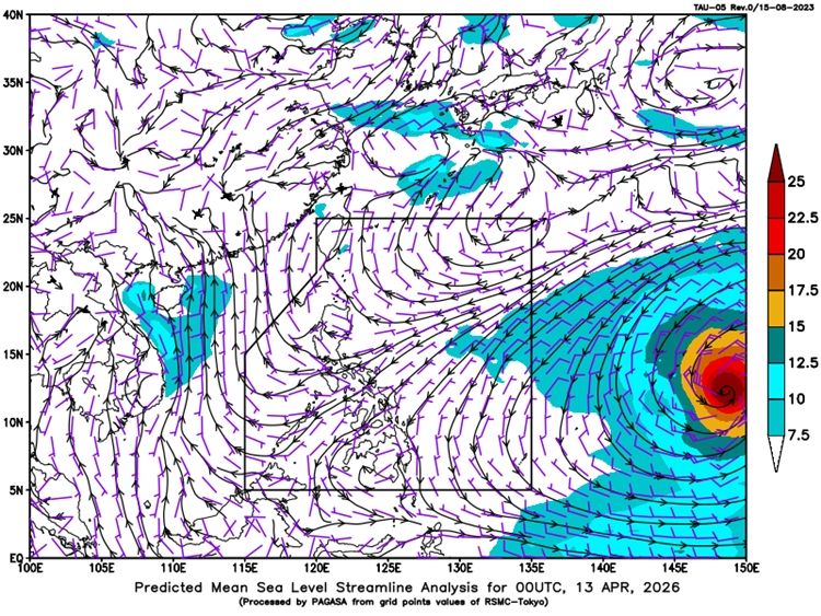
Wind conditions across Luzon, Visayas, and Mindanao are expected to remain light to moderate, with coastal waters staying slight to moderate. This means there are no major weather disturbances expected in most areas, allowing normal daily activities to continue.
Temperature levels over the past 24 hours ranged from 25°C to nearly 33°C, indicating warm and humid conditions typical for the season. Humidity levels also remained moderate to high, contributing to the overall warm weather.
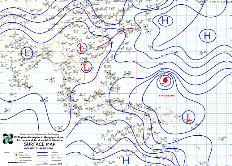
Meanwhile, the situation remains stable, with no immediate threat from Super Typhoon Sinlaku. Authorities continue to monitor its movement closely, but for now, the country can expect mostly clear weather with only occasional localized rain showers.