Latest Update on Typhoon Pepito
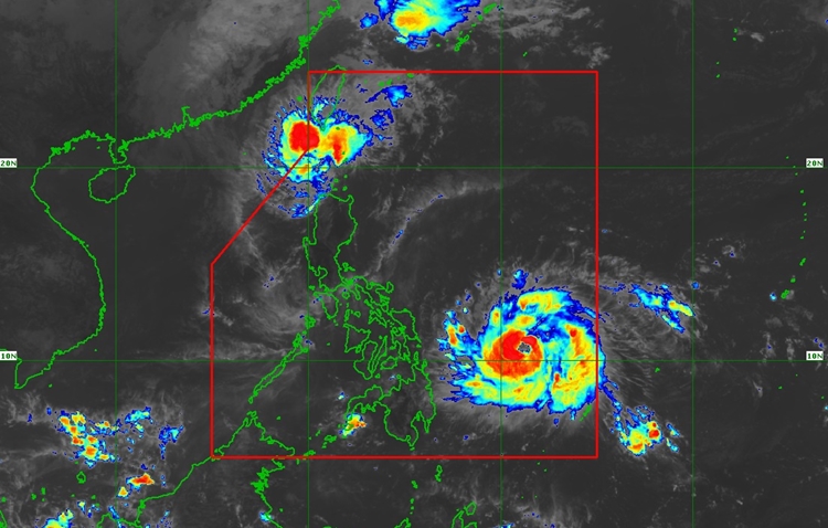
PAGASA LATEST UPDATE – Typhoon Pepito (MAN-YI) has intensified, with maximum sustained winds of 130 km/h near its center, gusts of up to 160 km/h, and a central pressure of 975 hPa as of November 15, 2024.
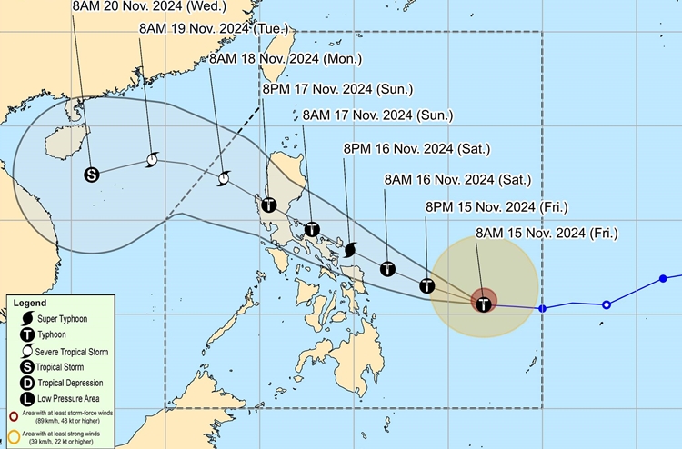
The typhoon is currently located 630 km east of Guiuan, Eastern Samar, and is moving westward at 30 km/h. Strong to storm-force winds extend up to 380 km from the center, affecting several regions in the Philippines.
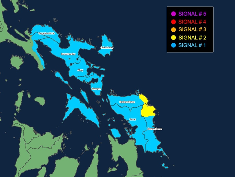
Tropical Cyclone Wind Signals (TCWS) have been issued: Signal No. 2 in parts of the Visayas, including northern and eastern portions of Samar and Eastern Samar, and Signal No. 1 in areas across Luzon and the Visayas. These signals indicate gale-force winds and strong winds, with the potential for minimal to moderate impacts on life and property.

Typhoon Pepito also brings a moderate to high risk of coastal inundation due to storm surges, with peak heights reaching up to 3.0 meters. Areas most at risk include southeastern Quezon, Camarines Sur, Catanduanes, Albay, Sorsogon, and parts of the Visayas. Sea conditions will also be dangerous, with very rough seas over the eastern seaboards of Samar and Northern Samar.

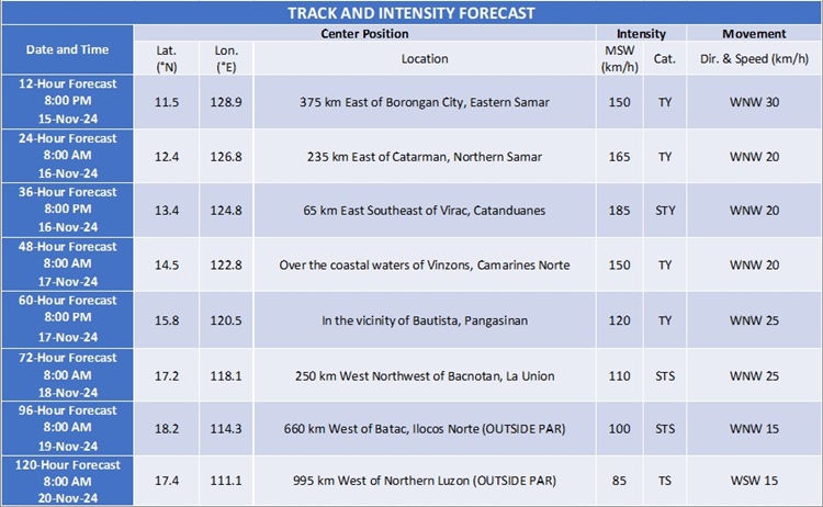
According to PAGASA, Typhoon Pepito is forecast to move west-northwest, with landfall expected near Catanduanes on the evening of November 16 or early morning on November 17. The typhoon is expected to intensify into a super typhoon before landfall but may slightly weaken after crossing the landmass. It will continue to affect Central Luzon and the Bicol Region before emerging into the West Philippine Sea by Sunday night or Monday morning.

The public is urged to take the necessary precautions, particularly those in areas at high risk of storm surges, strong winds, and heavy rainfall. Evacuations and other safety measures should be followed as advised by local authorities.

