Latest Update on Bagyong Marce
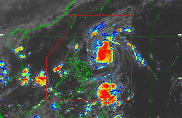
BAGYONG MARCE PAGASA UPDATE – Severe Tropical Storm Marce, internationally known as YINXING, has strengthened and is nearing typhoon status.
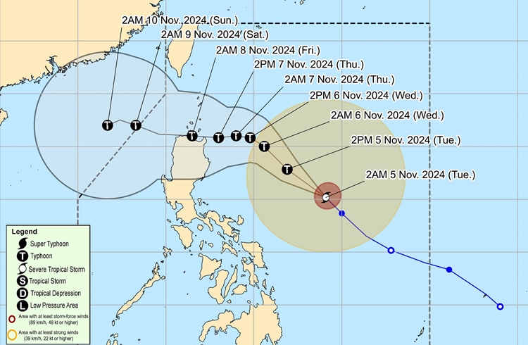
As of 4:00 AM today, Marce was located around 735 km east of Baler, Aurora, with sustained winds of 110 km/h and gusts up to 135 km/h. The storm is moving northwest at 25 km/h.
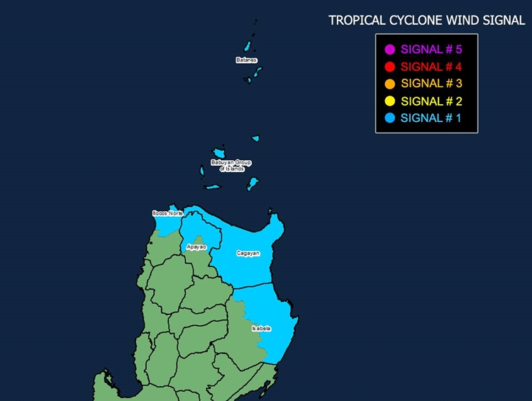
Tropical Cyclone Wind Signal (TCWS) No. 1 is currently in effect over several regions in northern Luzon, including Batanes, Cagayan (Babuyan Islands), parts of Isabela, Apayao, and Ilocos Norte. This signal indicates possible strong winds of 39-61 km/h within 36 hours, with minor impacts expected, particularly in open and elevated areas.

Marce is expected to bring heavy rainfall to certain areas. Localized severe winds may affect coastal and mountainous regions under TCWS No. 1. If Marce intensifies further, Wind Signal No. 4—the highest level—may be raised. Additionally, northeasterly winds will bring gusty conditions to Ilocos, Aurora, Quezon, and Camarines provinces today and tomorrow.
Meanwhile, a Gale Warning is in effect for the northern and eastern seaboards of Northern Luzon, where rough to very rough seas are anticipated. Waves up to 4.5 meters are expected around Batanes, Cagayan (Babuyan Islands), and Isabela, making sea travel hazardous. Mariners and small craft operators in these areas should remain in port or seek safe shelter.

Marce is forecasted to continue moving northwest before shifting westward over the Philippine Sea, with possible landfall in the Babuyan Islands or northern Cagayan by Thursday evening or early Friday. Due to potential changes in Marce’s path, residents are advised to stay updated as the storm may impact Cagayan-Isabela. Marce is expected to exit the Philippine Area of Responsibility by Friday evening or early Saturday.

PAGASA urges residents in affected areas to follow local disaster guidelines and prepare for evacuation if necessary. The next update will be issued at 11:00 AM.
