Wind Signals and Rainfall Warnings: What’s the Difference?
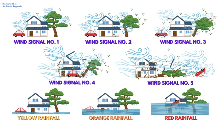
WIND SIGNALS VS. RAINFALL – A netizen shared a comparative illustration to clarify the distinction between wind signals and rainfall warnings.
According to Angelica Portia Forbes Regencia, many have expressed confusion, particularly during recent events with Severe Tropical Storm Kristine, where areas under Wind Signal No. 1 still experienced intense rainfall and flooding. Regencia’s post aims to explain that wind signals and rainfall warnings serve different purposes: Wind Signal No. 4 may have little rain, while Wind Signal No. 1 can bring torrential rain and flooding.
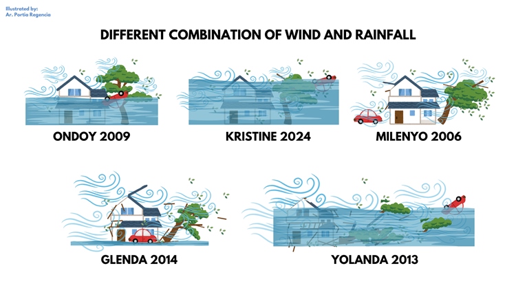
Her illustration further presents different wind and rainfall combinations based on typhoons over the past two decades, helping audiences understand these patterns without treating them as a “ranking” of storms. Initially intended for close friends and family, the illustration gained popularity as people shared it widely. Regencia noted that while not every storm was included, her work provides helpful context, especially when severe rain impacts areas with lower wind signal warnings.

Netizens expressed a variety of thoughts on Angelica Portia Forbes Regencia’s post about wind signals and rainfall warnings. Some pointed out that the speed of Tropical Storm Kristine could have influenced the severity of flooding in Bicol, suggesting that a faster movement might have lessened the impact. Others referenced the absence of Typhoon Odette in Luzon, comparing its effects to those of Typhoon Yolanda.

Meanwhile, as of the latest regional weather forecast issued on October 26, 2024, Severe Tropical Storm Trami (formerly known as Kristine) is currently located 630 kilometers west of Bacnotan, La Union. It is moving westward at a speed of 20 km/h and has maximum sustained winds of 95 km/h, with gusts reaching up to 115 km/h. The storm is no longer within the Philippine Area of Responsibility (PAR), but its trough is affecting the western section of Southern Luzon.
