Latest Update on Typhoon Uwan
Typhoon Uwan (Fung-Wong) has rapidly intensified over the Philippine Sea and is expected to affect several regions of the Philippines in the coming days.
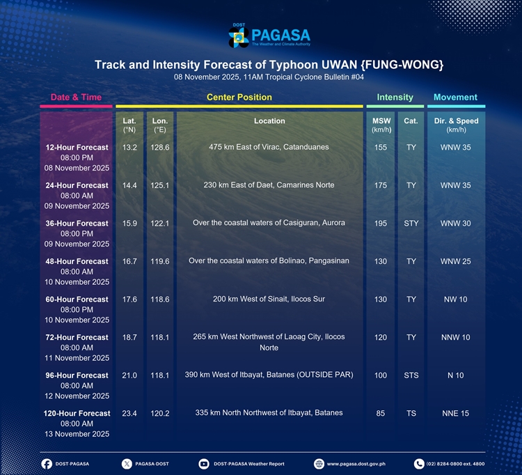
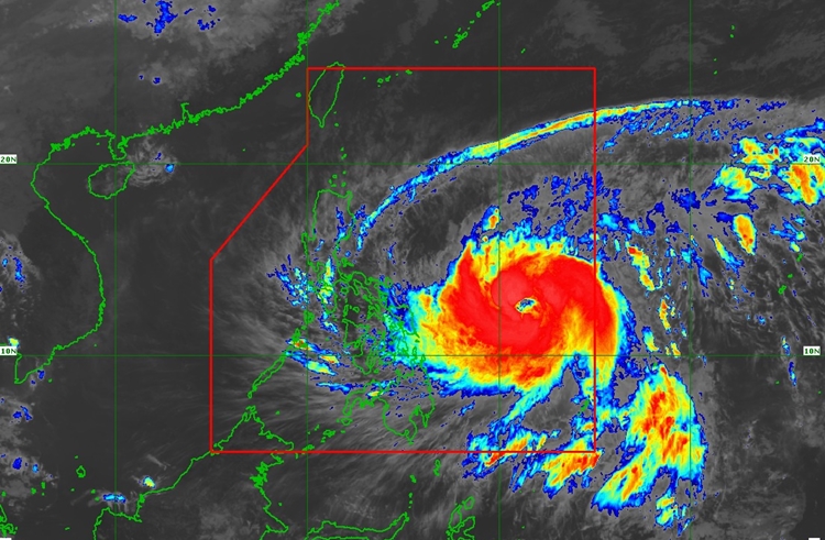
As of 10:00 AM on November 8, 2025, the storm was located approximately 680 kilometers east of Borongan City, Eastern Samar, moving westward at 35 kilometers per hour. Maximum sustained winds near the center reached 140 km/h, with gusts of up to 170 km/h, and a central pressure of 965 hPa. Typhoon-force winds are expected to extend as far as 780 kilometers from the storm’s center, affecting parts of Luzon, Visayas, and Mindanao.
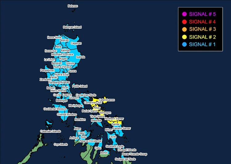
The Philippine Atmospheric, Geophysical, and Astronomical Services Administration (PAGASA) has issued Tropical Cyclone Wind Signals (TCWS) to alert residents. Areas under Signal No. 2, including Catanduanes, Albay, Sorsogon, and parts of Samar, may experience gale-force winds of 62 to 88 km/h, posing minor to moderate risks to life and property. Other regions, including Metro Manila, Cebu, Iloilo, and parts of Mindanao, are under Signal No. 1, indicating strong winds of 39 to 61 km/h with minimal to minor impacts. Coastal communities are also at high risk of storm surges exceeding three meters, particularly in northern and eastern Luzon, Eastern Visayas, and select islands in Mindanao.
Sea conditions are expected to be dangerous. Mariners are advised to remain in port or seek safe shelter, as waves may reach up to 14 meters in exposed areas. Small vessels, including motorbancas, are strongly discouraged from venturing out to sea. Heavy rainfall and strong winds may also affect areas outside the storm’s immediate path, increasing the risk of flooding and landslides in low-lying and mountainous regions.
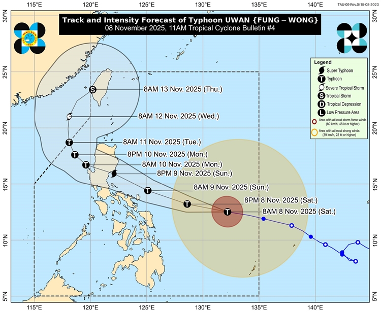
Typhoon Uwan is forecast to continue moving west-northwestward, with possible landfall near Catanduanes tomorrow morning or in the northern part of Aurora or southern Isabela by tomorrow evening or early Monday. The typhoon is expected to intensify rapidly, potentially reaching super typhoon strength. After crossing Northern Luzon, it will move over the West Philippine Sea, gradually weakening but remaining a typhoon throughout its passage.
Authorities and residents in affected areas are urged to take all necessary precautions to protect life and property. Evacuation measures should be followed where required, and the public is advised to monitor updates from PAGASA for localized warnings and advisories. The next tropical cyclone bulletin will be issued at 5:00 PM today.