Latest Update on Typhoon Marce According to PAGASA
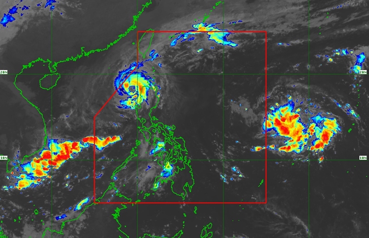
BAGYONG MARCE – Typhoon Marce (international name Yinxing) has slightly weakened but continues to move westward across the West Philippine Sea, according to PAGASA’s 8:00 AM update on November 8, 2024.
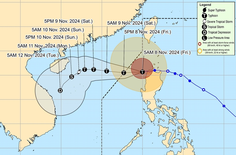
According to the state weather bureau, the eye of Marce was located approximately 100 km west-northwest of Laoag City, Ilocos Norte. It has maximum sustained winds of 150 km/h near the center, with gusts reaching up to 205 km/h. The typhoon is moving west-southwest at 15 km/h, with strong winds extending outward up to 500 km from its center.
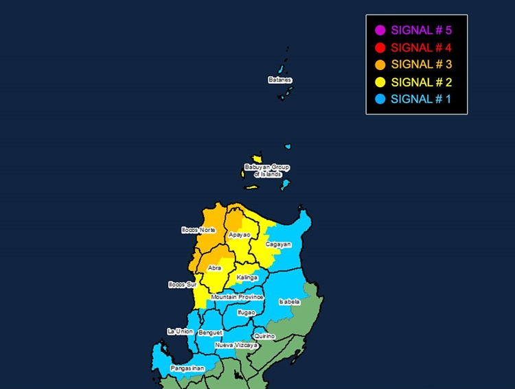
Tropical Cyclone Wind Signals (TCWS) have been raised over parts of Luzon. Areas under TCWS No. 3, including Ilocos Norte, sections of Cagayan, Apayao, Abra, and Ilocos Sur, should expect storm-force winds within 18 hours, with speeds ranging from 89 to 117 km/h, potentially causing moderate to significant impacts on life and property. Meanwhile, TCWS No. 2 is in effect for parts of the Babuyan Islands, western Cagayan, Apayao, Abra, Kalinga, and central Ilocos Sur. These areas should prepare for gale-force winds reaching up to 88 km/h within 24 hours, which could cause minor to moderate damage. Finally, TCWS No. 1 affects regions including Batanes, Babuyan Islands, Cagayan, Isabela, Nueva Vizcaya, Quirino, Mountain Province, Ifugao, Benguet, Ilocos Sur, La Union, and Pangasinan, where wind speeds are expected to range from 39 to 61 km/h.

Marce is also expected to bring significant coastal hazards, with storm surges as high as 3.0 meters likely along the coasts of Cagayan, Babuyan Islands, Isabela, Ilocos Norte, Ilocos Sur, and La Union. Gale warnings are in effect for the seaboards of Northern Luzon, with seas forecasted to be very rough, reaching heights of up to 6.0 meters along the Ilocos coastline.

Marce is expected to weaken as it interacts with dry air from the prevailing northeasterly wind flow, although it will likely maintain typhoon status until it exits the Philippine Area of Responsibility (PAR) later today or this evening. A southwestward track is anticipated by November 10, influenced by intensified northeasterly winds. Residents in affected areas are strongly advised to take precautionary measures, follow evacuation orders if issued, and monitor further updates from PAGASA. The next bulletin will be released at 11:00 AM.

