Latest Update on Bagyong Nika
BAGYONG NIKA – PAGASA, the state weather bureau, has released the latest update on Tropical Depression Nika for November 9, 2024.
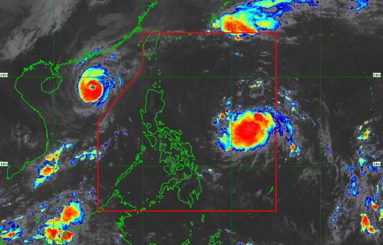
Nika, located 1,145 km east of Southeastern Luzon, is moving westward at 30 km/h, with maximum sustained winds of 55 km/h and gusts up to 70 km/h.
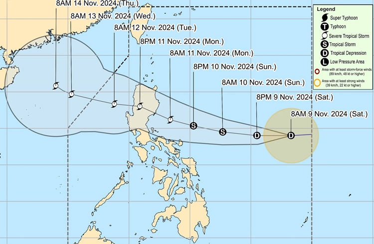
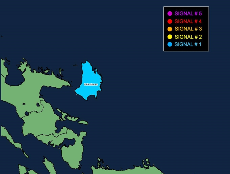
Bagyong Nika is expected to gradually intensify and may reach severe tropical storm strength by Monday, November 11, before making landfall over Isabela or Aurora. The storm is currently under Wind Signal No. 1 in Catanduanes, where strong winds are expected to cause minimal to minor impacts on life and property. The highest wind signal that may be issued during the storm’s passage is Signal No. 3.

In addition to the wind threat, heavy rainfall from Nika could lead to potential flooding in several areas. Coastal regions, especially the northern and eastern seaboards of Catanduanes and Kalayaan Islands, are advised to be cautious due to rough seas with waves as high as 3.0 meters. Mariners in small vessels are particularly advised to avoid sailing under these conditions. Other areas, including Isabela, Aurora, and Camarines Norte, may experience moderate seas of up to 2.5 meters, with additional coastal areas facing seas of up to 2.0 meters. Vessels in these areas are encouraged to take necessary precautions.

Bagyong Nika is forecast to continue its westward track, with landfall expected on November 11. Although weakening is expected due to interaction with the terrain of mainland Luzon, Nika will likely remain a severe tropical storm.

Authorities have advised the public, particularly those in highly vulnerable areas, to take all necessary precautions, follow evacuation orders, and stay updated with local weather advisories from PAGASA. The storm’s impacts may extend beyond the landfall region, and more warnings are expected as the situation develops. The next tropical cyclone bulletin will be issued by PAGASA at 5:00 PM today.
