Latest Update on Bagyong Marce
BAGYONG MARCE – The Philippine Atmospheric, Geophysical, and Astronomical Services Administration (PAGASA) has released an update on Typhoon Marce as of 8:00 AM today, November 7, 2024.
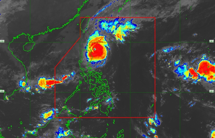
According to the state weather bureau, Typhoon Marce (Yinxing) has slightly intensified while moving slowly over the sea east of Cagayan. The storm is currently located 175 km east of Aparri, Cagayan, with maximum sustained winds of 165 km/h near the center and gusts of up to 205 km/h. The typhoon’s winds extend up to 560 km from its center. Marce is moving west-northwestward at a slow pace, and its central pressure is measured at 945 hPa.
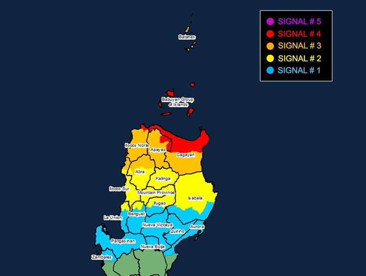
Bagyong Marce has triggered various Tropical Cyclone Wind Signals (TCWS) in affected areas. TCWS No. 4, indicating storm-force winds, is in effect for the northern part of mainland Cagayan, including the Babuyan Islands, Apayao, and parts of Ilocos Norte. These areas are at significant risk, with winds ranging from 118 to 184 km/h. TCWS No. 3, affecting Batanes, the rest of Cagayan, Apayao, Ilocos Norte, and other nearby regions, signals moderate to significant impacts from winds. TCWS No. 2 and No. 1, covering other parts of Luzon, indicate gale-force and strong winds, respectively, with varying levels of risk to life and property.

The typhoon is expected to cause severe rainfall, strong winds, and storm surges over coastal areas, particularly in Cagayan, Ilocos Norte, and other northern provinces. Storm surge warnings have been issued, with a high risk of life-threatening surges in low-lying or exposed coastal areas, especially in Batanes, Cagayan, and Babuyan Islands. The gale warnings suggest rough sea conditions, especially over the northern Luzon coasts, making sea travel highly dangerous.

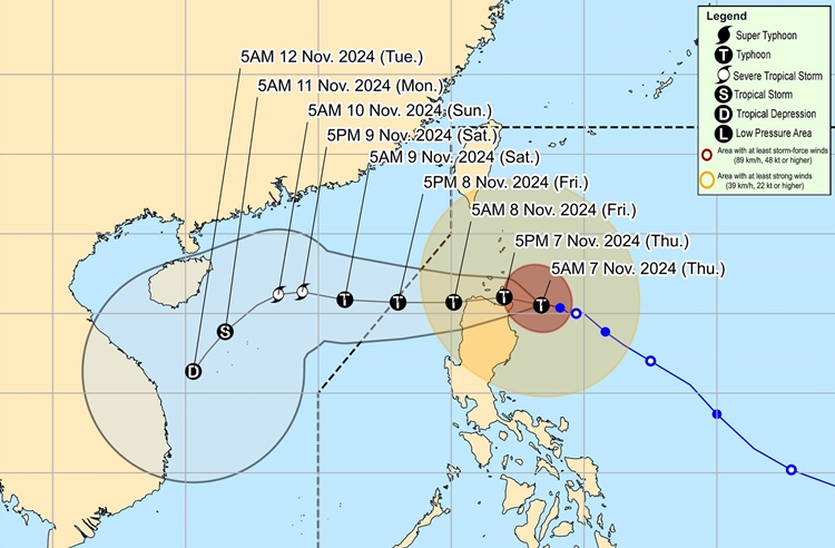
In terms of movement, Bagyong Marce is predicted to continue west-northwestward for the next 12 hours, possibly making landfall over Babuyan Islands or the northern portions of mainland Cagayan and Ilocos Norte later today or early tomorrow. The storm is expected to weaken slightly due to interaction with the terrain, but it will remain a typhoon as it moves through the Philippine Area of Responsibility (PAR). Marce may exit the PAR by tomorrow afternoon or evening, but continued weakening is expected over the weekend as it encounters further land interactions.

Residents in vulnerable areas are urged to follow evacuation orders and take necessary precautions to protect life and property. The public is advised to stay informed through updates from local authorities and PAGASA.
