Latest Update on Tropical Storm Kristine According to PAGASA
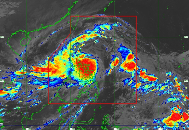
PAGASA LATEST WEATHER UPDATE – Tropical Storm Kristine continues to strengthen as it moves west-northwest over the sea east of Quezon.
As of 7:00 AM today, the storm’s center was located about 310 km east of Baler, Aurora, or 310 km east-northeast of Infanta, Quezon, with maximum sustained winds of 85 km/h and gusts reaching up to 105 km/h. The storm is moving at 15 km/h, and strong to gale-force winds extend up to 850 km from its center.
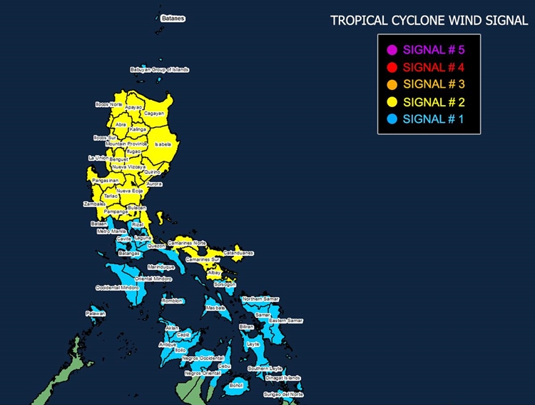
Tropical Cyclone Wind Signal (TCWS) No. 2 has been raised over parts of Luzon, including the Ilocos Region, Cagayan Valley, Central Luzon, and the Bicol Region. These areas may experience winds between 62 to 88 km/h, posing minor to moderate threats to life and property. Meanwhile, TCWS No. 1 is in effect over Metro Manila and parts of Luzon, Visayas, and Mindanao, with winds between 39 to 61 km/h. These areas face minimal to minor threats.

In addition to strong winds, heavy rainfall is expected, and there is a moderate to significant risk of life-threatening storm surges in low-lying coastal areas, particularly in Ilocos Norte, Ilocos Sur, La Union, Pangasinan, Cagayan, Isabela, Zambales, Aurora, Camarines Sur, and Catanduanes. The public is advised to monitor storm surge warnings and prepare accordingly.

Sea conditions are hazardous, with rough to high seas and waves reaching up to 8 meters in some areas, making sea travel risky for all vessels. Mariners are urged to stay in port or seek safe harbor until conditions improve.

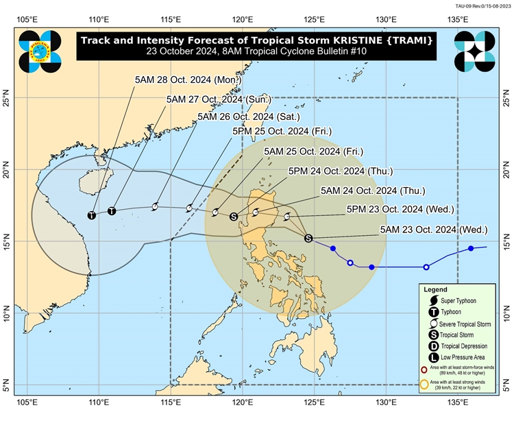
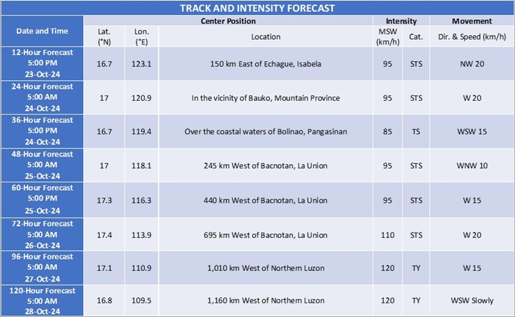
Tropical Storm Kristine is forecast to move northwestward for the next 12 hours before turning westward. It is expected to make landfall in Isabela or northern Aurora tonight or early tomorrow, with slight weakening anticipated as it crosses Northern Luzon. However, Kristine may re-intensify once it reaches the West Philippine Sea. The public is advised to follow local advisories and take precautions. The next bulletin will be issued by PAGASA at 11:00 AM today.

