Latest Update on Severe Tropical Storm Kristine
PAGASA LATEST WEATHER UPDATE – Severe Tropical Storm Kristine traverses the Cordillera Administrative Region, bringing intense weather conditions to Northern and Central Luzon.
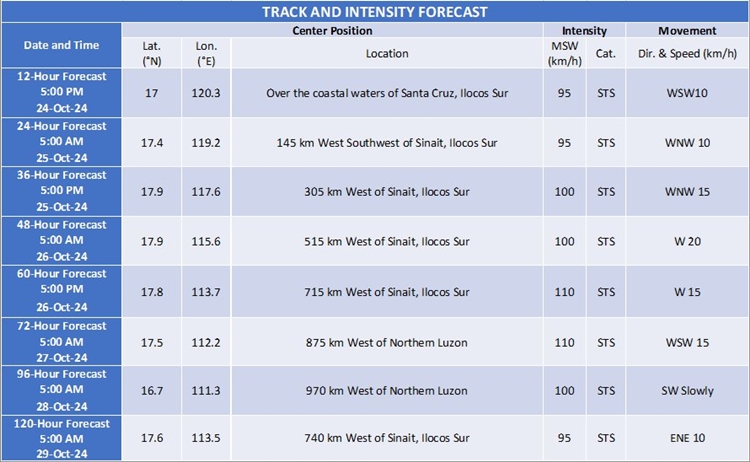
As of 7:00 AM, October 24, 2024, the storm’s center was located near Aguinaldo, Ifugao, with maximum sustained winds of 95 km/h and gusts reaching up to 160 km/h. Moving westward at 20 km/h, the storm is expected to cross Northern Luzon within the next 12 hours.
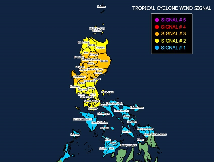
Tropical Cyclone Wind Signal (TCWS) No. 3 is currently in effect for several provinces, including Cagayan, Isabela, Kalinga, Mountain Province, and Ifugao, among others. Areas under this signal should brace for storm-force winds (89-117 km/h), which pose moderate to significant threats to life and property. Meanwhile, TCWS Nos. 2 and 1 are raised over other regions in Luzon and parts of the Visayas, indicating gale-force and strong winds, respectively. These signals warn of minimal to moderate impacts.
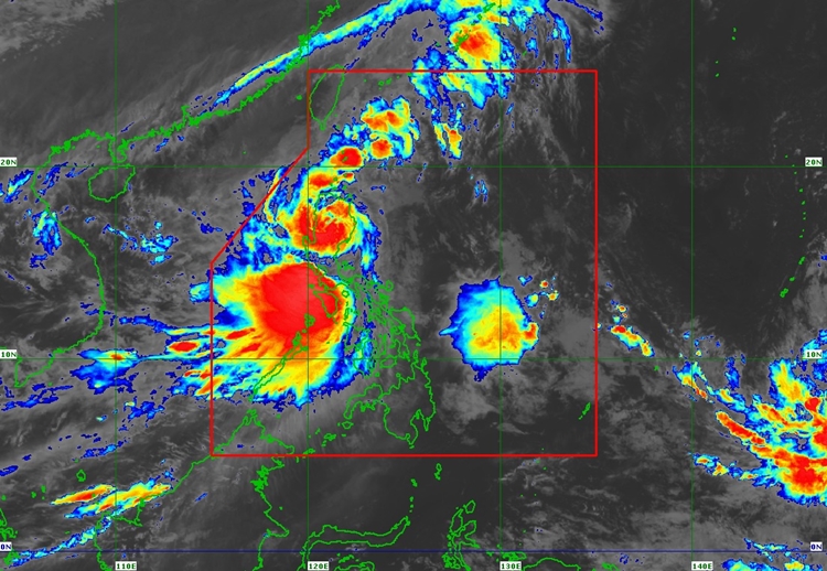
In addition to strong winds, Kristine is bringing heavy rainfall, which may lead to flooding and landslides in vulnerable areas. Coastal regions face a heightened risk of storm surges, with waves expected to reach up to 2 meters in low-lying areas of Ilocos, Cagayan, Isabela, and Zambales. Gale warnings have also been issued for the seaboards of Luzon and the Visayas, making sea travel extremely risky.
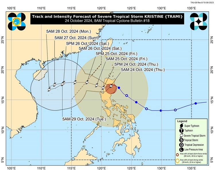
Kristine may slightly weaken as it interacts with land, with the possibility of being downgraded to a tropical storm. However, re-intensification is likely once it moves over the West Philippine Sea. The storm is expected to exit the Philippine Area of Responsibility by October 25, 2024.
Authorities urge the public, especially those in high-risk areas, to follow evacuation orders and prepare for potential hazards. Continuous monitoring of local advisories from PAGASA is essential for real-time updates on rainfall, winds, and other severe weather conditions.