Latest Update on Bagyong Leon (Kong-Rey)
PAGASA – The Philippine Atmospheric, Geophysical and Astronomical Services Administration has released an update about Bagyong Leon (international name Tropical Storm “Kong-Rey”).
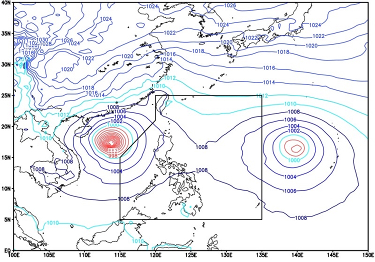
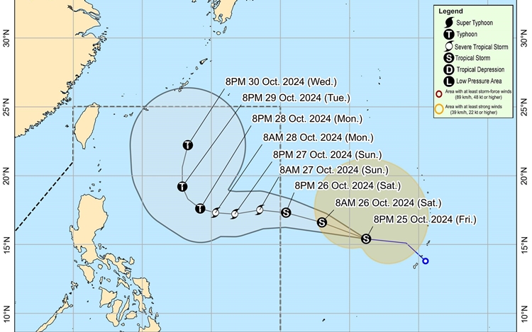
As of 4:00 AM on October 26, 2024, Tropical Storm “Kong-Rey” is located 1,825 kilometers east of Central Luzon, with maximum winds of 65 km/h and gusts up to 80 km/h, moving northwest at 35 km/h. Although it is far from land, it may still affect local weather.
At the same time, Severe Tropical Storm “Trami,” previously known as “Kristine,” is located 630 kilometers west of Bacnotan, La Union, with maximum sustained winds of 95 km/h and gusts reaching 115 km/h, moving west at 20 km/h.
The weather forecast shows varied conditions across the country. Occidental Mindoro and Palawan can expect cloudy skies with scattered rains and thunderstorms due to Trami’s influence, which may lead to flash floods or landslides from heavy rain. The Visayas, Zamboanga Peninsula, Northern Mindanao, and Caraga will also experience cloudy skies and possible thunderstorms, increasing the risk of flash floods and landslides. In Metro Manila and other areas, partly cloudy to cloudy skies with isolated rain showers or thunderstorms are expected, which may also cause flash floods and landslides.
Winds will be moderate to strong in Luzon, causing rough coastal waters between 2.8 and 4.0 meters. The Visayas and Mindanao will see slight to moderate winds, leading to moderate to rough coastal conditions of 1.5 to 2.5 meters.
Temperature extremes recorded in Quezon City over the past 24 hours ranged from a high of 31.6 °C to a low of 24.9 °C. For Metro Manila, sunrise is at 5:50 AM and sunset is at 5:30 PM. Tidal predictions for Manila Bay show a high tide of 1.05 meters at 3:44 AM and a low tide of -0.04 meters at 1:21 PM.
As Trami and Kong-Rey develop, residents are urged to stay updated through official weather reports and to prepare for severe weather, especially in areas prone to flooding and landslides.