Latest Update on Bagyong Leon Based on PAGASA
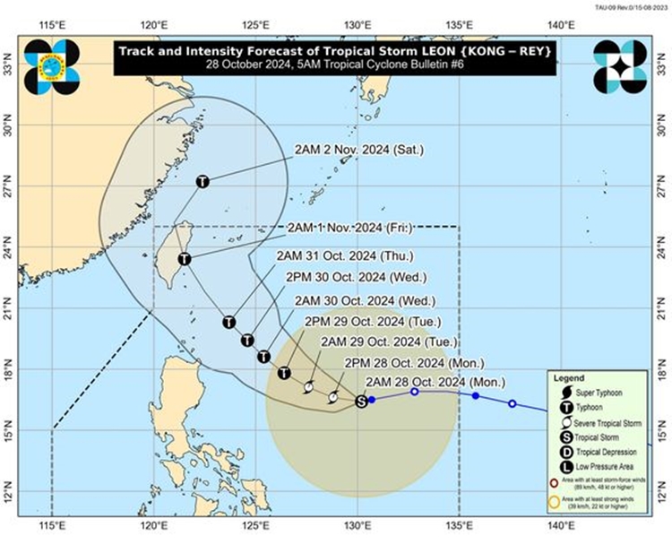
Bagyong Leon – Tropical Storm Leon (international name Kong-Rey) maintains its strength as it decelerates over the Philippine Sea, with its center located about 840 km east of Central Luzon as of 4:00 AM.
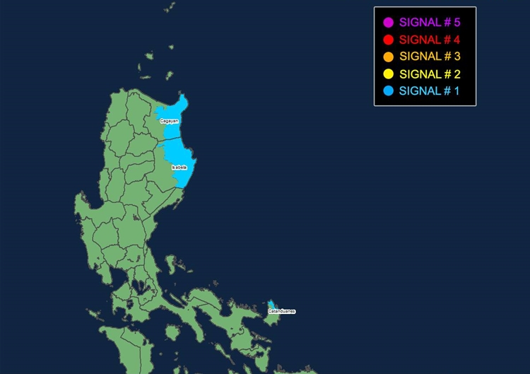
Leon has sustained winds of 85 km/h, with gusts reaching 105 km/h, and is moving westward at 10 km/h. Tropical Cyclone Wind Signal No. 1 has been raised over eastern Cagayan, Isabela, and northeastern Catanduanes, warning of possible minimal to minor wind damage within 36 hours. Depending on Leon’s approach, northern Luzon may experience heavy rains from its outer rainbands, while parts of Visayas, Mindanao, and southern Luzon could also be affected by rainfall from its trough.
As Bagyong Leon continues on its path, its effects are expected to reach several regions. Today, Batangas, MIMAROPA, Bicol, Visayas, Northern Mindanao, and Caraga are likely to experience strong to gale-force winds. By tomorrow, these gusty conditions are expected to extend to Aurora, Metro Manila, CALABARZON, and nearby areas, and by Wednesday, regions including Western Visayas and Northern Samar may also be affected. Coastal regions are under strict advisories due to dangerous sea conditions, with very rough seas reaching up to 4.5 meters in Batanes, posing significant risks to all vessels. Mariners, especially those in small craft, are advised to avoid going to sea.

Bagyong Leon is expected to intensify within the next 24 hours, potentially reaching severe tropical storm strength and may undergo rapid intensification. Its projected movement will shift west-northwestward by Tuesday morning, with a possible landfall over Taiwan by Friday, following a passage near Batanes between Wednesday and Thursday. Disaster preparedness measures are advised, especially for those in hazard-prone areas, and residents are urged to stay updated on local advisories from PAGASA and other official sources.

Meanwhile, the next update on Tropical Storm Leon will be issued by PAGASA at 11:00 AM today.

