Latest Update on Tropical Storm Enteng
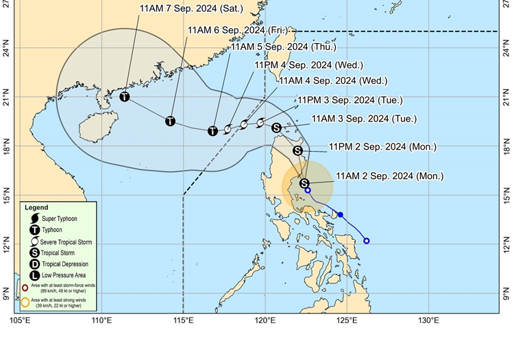
TROPICAL STORM ENTENG – PAGASA announced that the weather disturbance has intensified and is expected to make landfall over the Northern Aurora-Southeastern Isabela area within the next few hours.
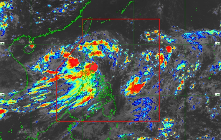
As of 1:00 PM, the storm’s center was located over the coastal waters of Casiguran, Aurora, with maximum sustained winds of 85 km/h and gusts up to 105 km/h. The storm is moving north-northwest at 20 km/h.
Tropical Cyclone Wind Signal No. 2 has been raised over several areas, including Ilocos Norte, Apayao, eastern Kalinga, Cagayan, Isabela, Quirino, and parts of Aurora and Camarines Norte, with gale-force winds (62-88 km/h) expected within the next 24 hours. Meanwhile, Signal No. 1 is in effect for Batanes, Ilocos Sur, La Union, eastern Pangasinan, and other parts of Luzon, where strong winds (39-61 km/h) are anticipated within 36 hours. Additionally, significant rainfall is expected, with potential flooding and landslides in affected areas.
Heavy rainfall is expected from today until tomorrow in northern Quezon, the Polillo Islands, Aurora, Isabela, Cagayan, Zambales, and western Pangasinan, with accumulated rainfall of 100-200 mm. The central parts of Quezon, Cavite, Batangas, Laguna, Rizal, Bulacan, Bataan, Nueva Ecija, and the Ilocos Region may receive 50-100 mm of rain.
From tomorrow until September 4, Ilocos Sur and Abra will experience heavy rains of 100-200 mm, with surrounding areas receiving 50-100 mm. Flooding and landslides are possible, especially in elevated or mountainous areas.
The highest wind signal that may be hoisted during Enteng’s passage is Signal No. 3. Additionally, a minimal to moderate risk of storm surge is expected in low-lying coastal areas of Batanes, Cagayan, Isabela, Ilocos Norte, Ilocos Sur, and Aurora.

Enteng is forecast to maintain its strength as it moves across Northern Luzon, emerging over the Luzon Strait by tomorrow morning. It is expected to intensify into a severe tropical storm by late tomorrow and possibly reach typhoon category by Thursday.