Here’s the latest update on Typhoon Goring according to PAGASA
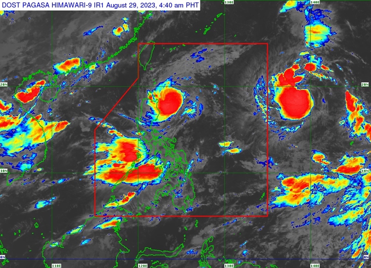
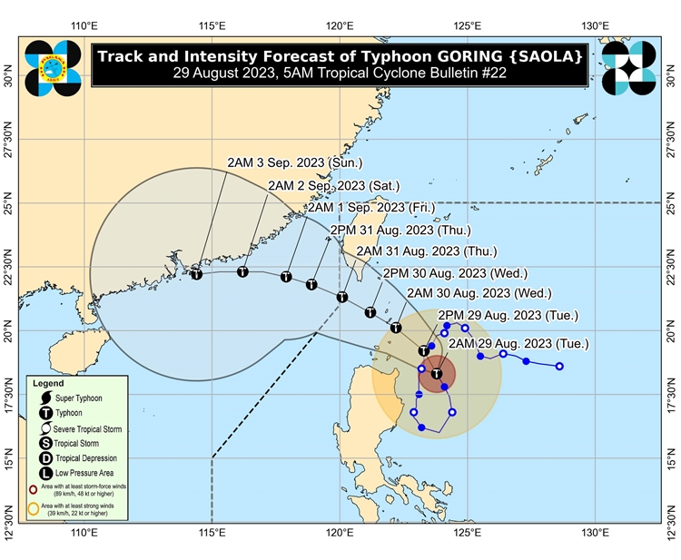
TYPHOON GORING – PAGASA announced via its latest bulletin issued at 5 AM today, August 29, 2023, that #GoringPH maintains its strength as it continues to approach the Luzon strait.
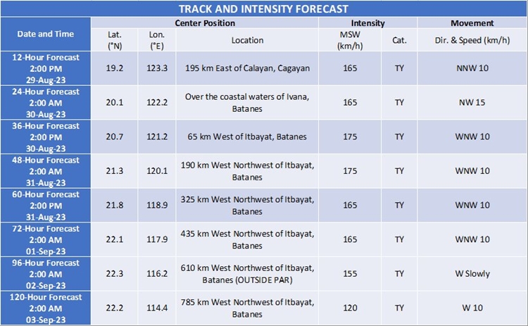
It is traversing North Northwestward at 10 km/h and has maximum sustained winds of 155 km/h near the center and gustiness of up to 190 km/h. The center of the eye of Typhoon Goring was located at 220 km East of Aparri, Cagayan (18.5 °N, 123.7 °E ).
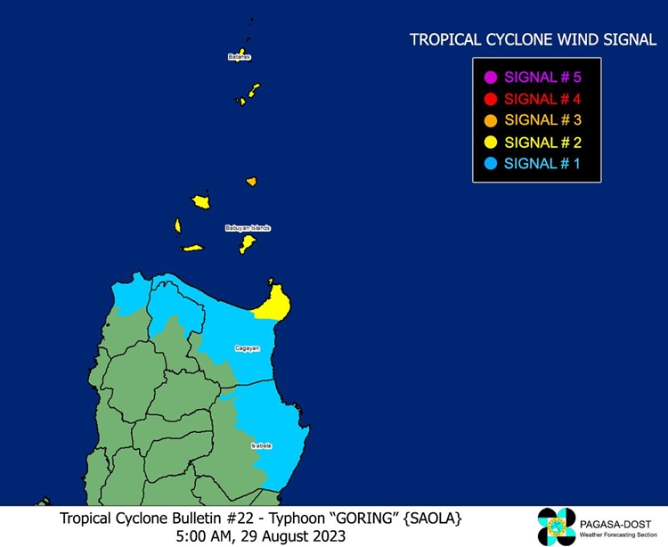
Tropical Cyclone Wind Signal no. 3 has been raised in the northeastern portion of Babuyan Islands (Babuyan Is.) while Tropical Cyclone Wind Signal no. 2 has been raised in Batanes, the rest of Babuyan Islands, and the extreme northeastern portion of mainland Cagayan (Santa Ana, Gonzaga).

On the other hand, Tropical Cyclone Wind Signal no. 1 has been raised in the northern and eastern portions of mainland Cagayan (Camalaniugan, Pamplona, Santa Teresita, Baggao, Buguey, Claveria, Aparri, Ballesteros, Abulug, Sanchez-Mira, Santa Praxedes, Allacapan, Lal-Lo, Lasam, Peñablanca, Iguig, Amulung, Gattaran, Alcala, Santo Niño), the eastern portion of Isabela (Dinapigue, San Mariano, Ilagan City, Tumauini, San Pablo, Cabagan, Maconacon, Divilacan, Palanan), the northern portion of Apayao (Flora, Calanasan, Luna, Pudtol, Santa Marcela), and the northern portion of Ilocos Norte (Vintar, Pasuquin, Burgos, Dumalneg, Adams, Pagudpud, Bangui).


Meanwhile, Goring may not escalate to a super typhoon but another severe tropical storm may enhance the southwest monsoon by Wednesday, Aug. 30, or Thursday, Aug. 31. According to PAGASA, the next advisory on Typhoon Goring today will be issued at 11 AM today.
Related Post: #GoringPH – Typhoon Goring Latest Advisory (August 28, 2023)
For more news and the latest updates, feel free to visit Newspapers.ph more often as well as our Facebook page and YouTube channel.
