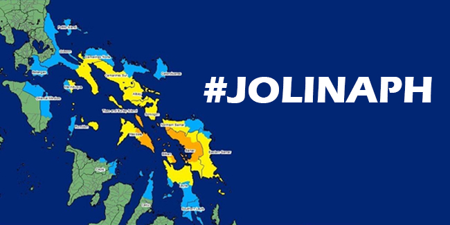
PAGASA recently explained why “Jolina” rapidly became a fierce cyclone.
#JOLINAPH — On Monday, the Philippine Atmospheric, Geophysical and Astronomical Services Administration (PAGASA) recently explained why “Jolina” rapidly became a fierce cyclone.

“Jolina”, also known for its international name “Conson”, had strengthened from a tropical depression into a typhoon in just a day.
PAGASA first spotted an LPA (low pressure area) east of Mindanao over the weekend. The LPA developed into a tropical cyclone on Monday and was assigned a local name “Jolina”.
“Jolina” was first classified by PAGASA as a tropical depression at around 2:00 am then a tropical storm at 2:00 pm.
After that, at around 5:00 pm, “Jolina” intensified into a severe tropical storm packing maximum sustained winds of 95kph (kilometers per hour) near the center and gustiness of up to 115kph.
At around 8:00 pm, the cyclone intensified into a typhoon unleashing maximum sustained winds of 120kph near the center and gustiness of up to 165kph along its path.
This had prompted PAGASA to raise tropical cyclone wind signal (TCWS) number 3 over several areas in Eastern Visayas.
According to PAGASA weather specialist Ariel Rojas, the typhoon’s rapid intensification can be attributed to the “favorable atmospheric and oceanic conditions” over the Philippine Sea and the typhoon’s “compact” structure had contributed to its rapid development.
Rojas also noted typhoon Jolina’s “erratic movement” that led to a high track uncertainty aside from its quick intensification.
As it’s a compact cyclone, Rojas said that weather models and observation stations had difficulty capturing the weather system’s movement. The typhoon was initially projected to make landfall over northern Luzon but PAGASA had not ruled out the possible landfall over Eastern Visayas.
READ ALSO: Samsung Intros Eco-Package Initiative That Can Turn Cardboard Boxes Into Useful Items
Manila Bulletin reported that “Jolina” has so far made landfall three times – in Hernani, Eastern Samar at 10:00 pm on Monday, in Daram, Samar at 2:00 am on Tuesday, and Sto Niño, Samar at 3:40 am on Tuesday.
Rojas added that the typhoon may move towards mainland Luzon after crossing the islands of southern Luzon. According to him, it’s likely that Metro Manila, Laguna, Cavite, Rizal, Quezon, Batangas, Oriental Mindoro, Marinduque, Occidental Mindoro, Romblon, and Palawan may start to experience “deteriorating” weather conditions around Tuesday noon.
“The threat of flooding and landslides is high in low-lying areas, riverbanks, and mountainous areas especially in Bicol, Calabarzon, and Mimaropa,” Rojas said.
Rojas also said that “Jolina” may weaken and could be downgraded into a severe tropical storm because of the land interaction of the typhoon and will likely further weaken into a tropical storm while crossing Central Luzon.
Moreover, Rojas said that “Jolina” will likely leave the Philippine area of responsibility (PAR) by September 10.
For more news and updates, you may feel free to visit this site more often. You may also visit Newspapers.ph via our official Facebook page and YouTube channel.
